
Grounds map and outdoor areas
Put outdoor jobs on a real map of your site, draw named areas like parking and fields, and give each building its own grounds.
On this page
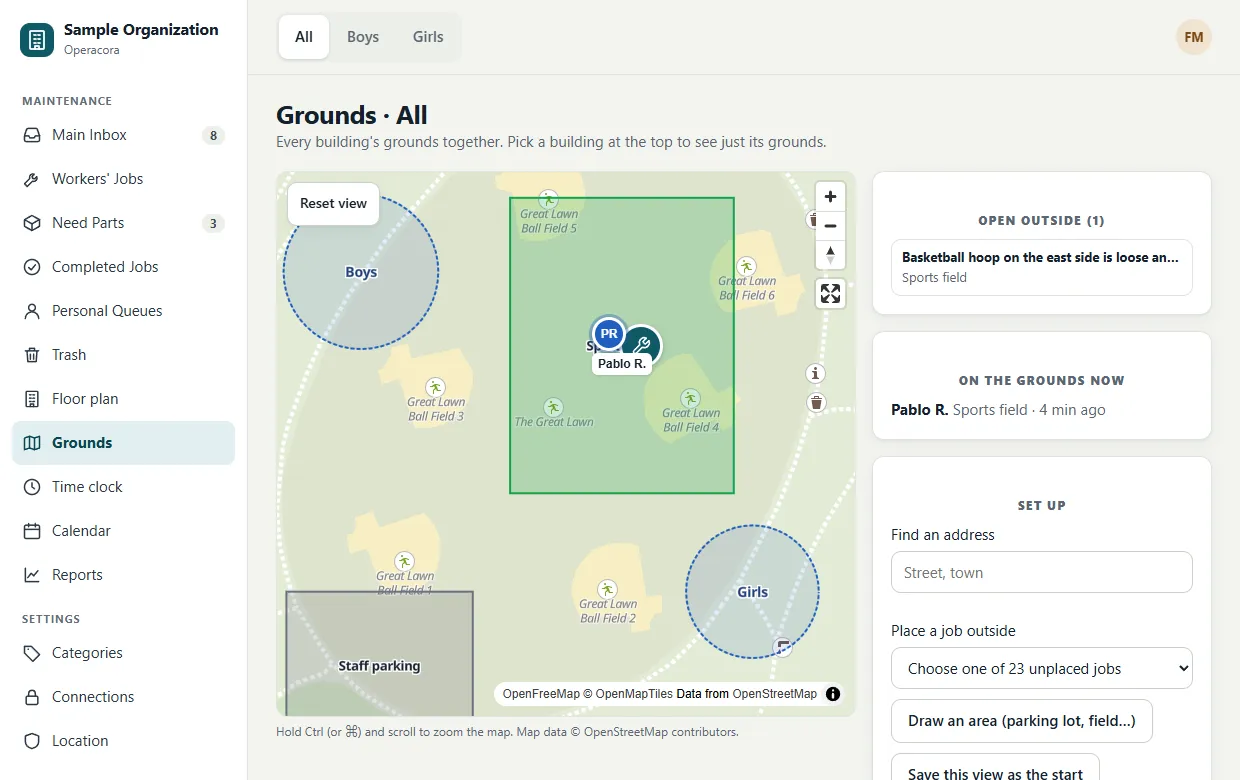
Not every job is inside. The Grounds page is a real outdoor map of your site where outdoor jobs light up just like pins on a floor plan. Everyone can open it; workers see only their own jobs.
Find your way around#
- Drag to move. To zoom, scroll with the mouse over the map, use the + and − buttons, or pinch on a touch screen.
- Reset view goes back to where the map starts; the full-screen button gives you the whole window.
- Buildings appear as circles from Settings › Location. Click one to open its floor plans.
- The building switch at the top shows one building's grounds, or All of them together.
Set up the map#
- Find your site. Type an address under Find an address and pick it. This needs a Geoapify connection; you can also simply drag and zoom.
- Save the start view. Frame the site and press Save this view as the start. Each building has its own start view, and so does All.
- Draw outdoor areas. Press Draw an area (parking lot, field…), click the corners on the map, press Finish area, then name it and choose a kind: parking, field, playground, entrance, garden, path or other.
Areas drawn while a building is selected belong to that building. Areas drawn under All are shared by every building.
Put a job outside#
A job is either in a room or at an outdoor spot, never both.
- On the Grounds page, choose a job under Place a job outside, then click the map where it is.
- Or, on the job's page, press Place outside next to the room, then click the map.
Outdoor pins use the same icons and severity look as floor-plan pins. The Open outside panel lists them. To move a pin, use Move on the grounds map on the job.
Satellite view (optional)#
If your organization adds a MapTiler connection, a Map / Satellite switch appears. Each person's choice is remembered in their browser.
People on the grounds#
When location while clocked in is on, people who are outside every building but inside a named area show at that area's centre, under On the grounds now. Only the area is stored, never an exact position.
The map uses OpenStreetMap data through OpenFreeMap: no key and no bill. The phone app's Map tab shows the grounds too.